news
After the siege Google updated its satellite images of Mariupol for the first time since 2021. The photos show destruction on a catastrophic scale.
Source: Meduza
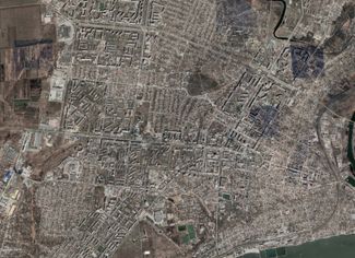
On April 25, Google Earth and Google Maps updated their satellite images of Mariupol. The previous satellite images were from June 2021, before Russia’s full-scale invasion of Ukraine. The new photographs were taken at different times following the start of the war, which is why fires are visible in some parts of the city, while in other areas occupying authorities are seen constructing new buildings. What’s more, one newly reconstructed area of Mariupol, which Vladimir Putin visited in March 2023, isn’t visible at all. The following photographs from Google Earth offer a glimpse at the extent of the destruction inflicted upon Mariupol since the start of the Russian invasion.
Mariupol’s city center

The dark squares visible in the image on the right were not caused by combat operations. They are inserts from a different satellite.
The Mariupol Drama Theater
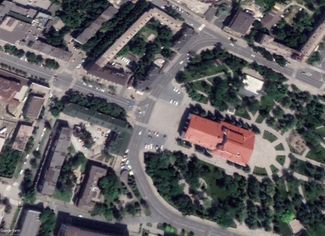
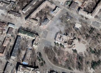
The satellite images above show the Mariupol Drama Theater, which was destroyed by two Russian airstrikes. In March 2022, the word “children” was written to the left of the building to indicate that this was serving as a bomb shelter for Mariupol residents. According to the Associated Press, approximately 600 civilians were killed in the airstrikes that hit the building. This is not a recently updated image – Russian occupation authorities demolished the Drama Theater in December 2022.
Craters from artillery fire in eastern Mariupol
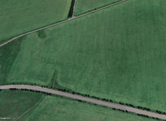
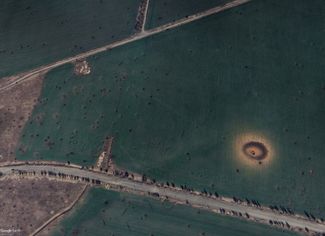
The updated image on the right shows a crater that was likely caused by a powerful aerial bomb. The crater’s diameter is approximately 70 meters (76.5 yards). Nearby, numerous craters caused by artillery fire are visible, as well.
A line outside of a United Russia assistance center in Mariupol
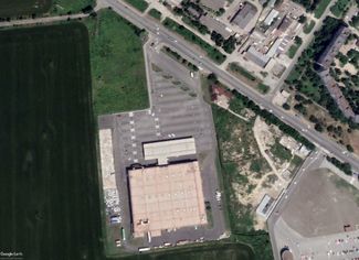
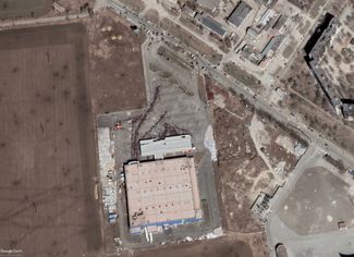
The images above show a former grocery store on Mariupol’s western outskirts. After the city’s capture, the Russian army opened an assistance center inside the store. The updated image on the right shows massive queues, made up of the city’s residents who came to the center for humanitarian aid. To see how the lines looked on the ground, take a look here.
Checkpoint on the way to Azovstal Iron and Steel Works
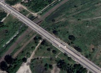
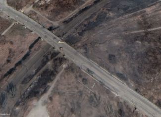
A checkpoint on a bridge passing over a railway line near the Azovstal plant. The railway is no longer operational. Previously, it supplied millions of tons of raw materials to the plant each year (and to parts of the Donbas that Kyiv hasn’t controlled since 2014).
The Azovstal Iron and Steel Works
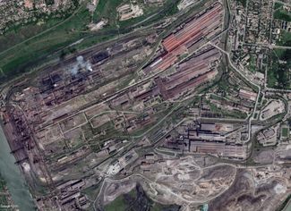
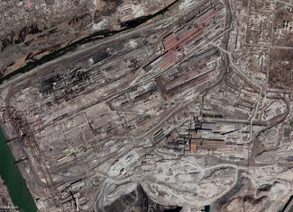
The images above show the extent of the damage to the Azovstal plant. The industrial complex, which was the last stronghold for the defenders of Mariupol, was hit by airstrikes (including high-caliber bombs) and heavy mortars. Azovstal became a symbol of Ukrainian resistance, withstanding a two-month siege by the Russian army. The occupying authorities have announced that they will not rebuild the plant.
The Staryi Krym cemetery
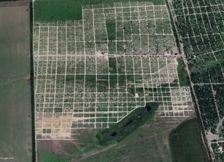
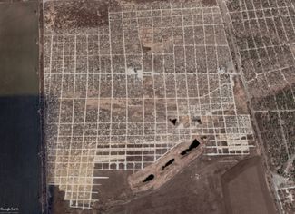
The Staryi Krym cemetery on the western outskirts of Mariupol. Hundreds of new graves are visible in the updated satellite image on the right. The majority of the graves are reportedly unmarked.

Reportage by Meduza
Translation by Sasha Slobodov